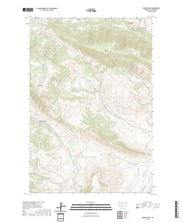
2024 Map of Chimney Rock
USGS Topo · Published 2024About this map
Paradise Valley serves as the focal point of this Park County landscape, where the valley floor meets the rising peaks of the Absaroka Range. The small settlement of Wineglass sits at the northern edge, overshadowed by Wineglass Mtn and the distinct formation of The Hogback. This modern survey reveals a complex network of agricultural water management, including the Maxey Ditch, Highline Ditch, and Park Branch Canal, which trace the contours of the valley to sustain the local ranching economy.
Find a feature on this map
49 named features on this map. Tap any name to fly to it.
Don’t see what you’re looking for? This feature index may not catch every label — zoom into the map to look around manually.
Map Details
Editions of this 2024 Chimney Rock Map
This is the sole edition of this map. No revisions or reprints were ever made.
Other maps of this area

1891 · Livingston
USGS Topo · 1:250,000

1893 · Livingston
USGS Topo · 1:250,000

1947 · Bozeman
USGS Topo · 1:250,000

1948 · Bozeman
USGS Topo · 1:250,000

1951 · Bozeman Pass
USGS Topo · 1:62,500

1951 · Brisbin
USGS Topo · 1:24,000

1951 · Hoppers
USGS Topo · 1:24,000

1951 · Chimney Rock
USGS Topo · 1:24,000
1951 · Livingston
USGS Topo · 1:24,000

1955 · Bozeman
USGS Topo · 1:250,000