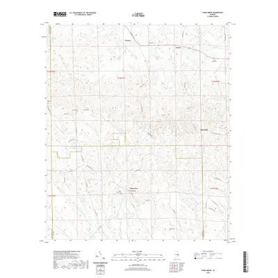
2020 Map of China Grove
USGS Topo · Published 2020About this map
China Grove serves as a central point of interest in this rural Alabama landscape, where the headwaters of numerous creeks begin their descent toward the surrounding river basins. The topography is defined by the winding paths of China Grove Cr, Colman Cr, and Panther Cr, which carve through the terrain between the small settlements of Shopton, Hector, and High Ridge. Genealogists will find significant value in the distribution of family and community burial grounds across the area, including Pickett Cem in the north and China Grove Cem near the town center. The network of county roads, such as Old Salem Rd and Bullock Co 37, highlights a long-standing rural infrastructure that has connected these isolated farming communities and local landmarks like Bear Lake for generations.
Find a feature on this map
57 named features on this map. Tap any name to fly to it.
Don’t see what you’re looking for? This feature index may not catch every label — zoom into the map to look around manually.
Map Details
Editions of this 2020 China Grove Map
This is the sole edition of this map. No revisions or reprints were ever made.
Other maps of this area

1953 · Montgomery
USGS Topo · 1:250,000

1953 · Andalusia
USGS Topo · 1:250,000

1953 · Dothan
USGS Topo · 1:250,000

1954 · Dothan
USGS Topo · 1:250,000

1955 · Dothan
USGS Topo · 1:250,000

1955 · Phenix City
USGS Topo · 1:250,000

1956 · Montgomery
USGS Topo · 1:250,000

1957 · Phenix City
USGS Topo · 1:250,000

1957 · Montgomery
USGS Topo · 1:250,000

1957 · Andalusia
USGS Topo · 1:250,000