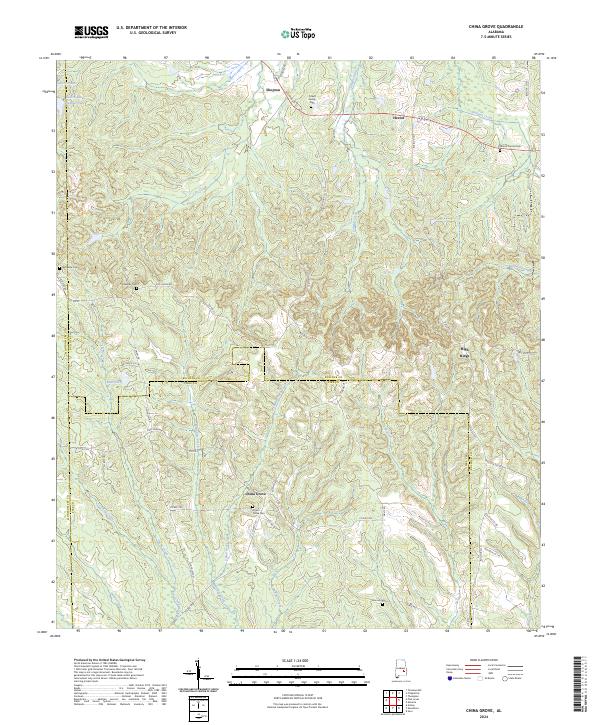
2024 Map of China Grove
USGS Topo · Published 2024About this map
China Grove serves as the focal point of this rural landscape where Bullock, Montgomery, and Pike counties converge. The terrain is defined by a dense network of creek systems, including China Grove Creek, Dicky Creek, and Manning Creek, which cut through the low-lying hills. This 2024 survey documents the enduring settlement patterns of the region, anchored by small crossroads communities like Shopton, Hector, and High Ridge. For genealogists and local historians, the map is a primary resource for locating family burial grounds, such as the Pickett Family Cem, China Grove Cem, and Dennis Cem. The presence of several family-named cemeteries and landmarks like Edwards Cem reflects a deeply rooted agricultural heritage. Modern infrastructure, including Old Pike Rd and Mary Weather Trl, overlays the historic paths through the Line Creek and Indian Creek drainages.
Find a feature on this map
62 named features on this map. Tap any name to fly to it.
Don’t see what you’re looking for? This feature index may not catch every label — zoom into the map to look around manually.
Map Details
Editions of this 2024 China Grove Map
This is the sole edition of this map. No revisions or reprints were ever made.
Other maps of this area

1953 · Montgomery
USGS Topo · 1:250,000

1953 · Andalusia
USGS Topo · 1:250,000

1953 · Dothan
USGS Topo · 1:250,000

1954 · Dothan
USGS Topo · 1:250,000

1955 · Dothan
USGS Topo · 1:250,000

1955 · Phenix City
USGS Topo · 1:250,000

1956 · Montgomery
USGS Topo · 1:250,000

1957 · Phenix City
USGS Topo · 1:250,000

1957 · Montgomery
USGS Topo · 1:250,000

1957 · Andalusia
USGS Topo · 1:250,000