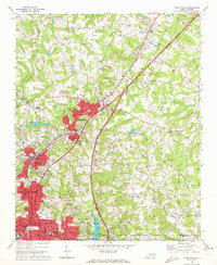
1970 Map of China Grove
USGS Topo · Published 1972About this map
China Grove and Landis anchor a corridor of rapid industrial and residential expansion in the early 1970s, as the urban footprint of Kannapolis pushes northward across the Rowan Co and Cabarrus Co line. This landscape is defined by the Southern railroad and parallel highway corridors that fostered the growth of textile communities and surrounding neighborhoods. The transition from agricultural roots to a modern infrastructure is visible through the presence of the China Grove Airport, the Rowan Correction Center, and numerous local institutions like the South Rowan High Sch.
Find a feature on this map
72 named features on this map. Tap any name to fly to it.
Don’t see what you’re looking for? This feature index may not catch every label — zoom into the map to look around manually.
Map Details
Editions of this 1970 China Grove Map
2 editions found
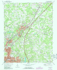
Other maps of this area

1893 · Statesville
USGS Topo · 1:125,000

1941 · Charlotte
USGS Topo · 1:125,000

1942 · Charlotte
USGS Topo · 1:125,000

1949 · Kannapolis
USGS Topo · 1:24,000

1950 · Concord
USGS Topo · 1:24,000

1953 · Charlotte
USGS Topo · 1:250,000

1954 · Charlotte
USGS Topo · 1:250,000

1957 · Mount Pleasant
USGS Topo · 1:62,500

1960 · Charlotte
USGS Topo · 1:250,000

1962 · Charlotte
USGS Topo · 1:250,000