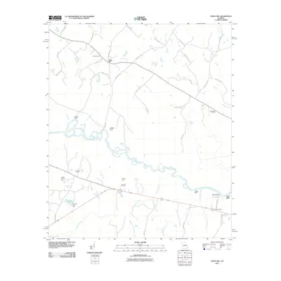
2011 Map of China Hill
USGS Topo · Published 2011About this map
China Hill and the surrounding agricultural landscape of Ben Hill County are defined by the winding course of the Ocmulgee River. This 2011 survey captures the area's rural character, where the river's path is marked by high points such as Yellow Bluff and Mobley Bluff. The map preserves the locations of several family and community landmarks, including Bethel Cemetery and Black House Cemetery, which provide valuable touchstones for genealogical research.
Find a feature on this map
47 named features on this map. Tap any name to fly to it.
Don’t see what you’re looking for? This feature index may not catch every label — zoom into the map to look around manually.
Map Details
Editions of this 2011 China Hill Map
This is the sole edition of this map. No revisions or reprints were ever made.
Other maps of this area

1953 · Waycross
USGS Topo · 1:250,000

1958 · Waycross
USGS Topo · 1:250,000

1972 · Cooks Still
USGS Topo · 1:24,000

1972 · Broxton North
USGS Topo · 1:24,000

1972 · Jacksonville
USGS Topo · 1:24,000

1972 · Fitzgerald East
USGS Topo · 1:24,000

1972 · China Hill
USGS Topo · 1:24,000
1972 · Workmore
USGS Topo · 1:24,000

1972 · Queensland
USGS Topo · 1:24,000

1977 · Osierfield
USGS Topo · 1:24,000