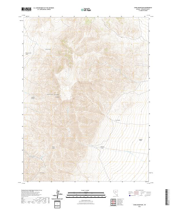
2021 Map of China Mountain
USGS Topo · Published 2021About this map
The Tobin Range dominates this portion of Pershing County, rising between two distinct basins in the Great Basin landscape. To the west lies the Pumpernickel Valley, while the eastern portion of the map transitions into the Buffalo Valley. This high-elevation terrain is centered on the prominent China Mtn, which serves as a natural divide for several seasonal drainage systems.
Find a feature on this map
22 named features on this map. Tap any name to fly to it.
Don’t see what you’re looking for? This feature index may not catch every label — zoom into the map to look around manually.
Map Details
Editions of this 2021 China Mountain Map
This is the sole edition of this map. No revisions or reprints were ever made.
Other maps of this area

1932 · Sonoma Range
USGS Topo · 1:250,000

1939 · Sonoma Range
USGS Topo · 1:250,000

1955 · Winnemucca
USGS Topo · 1:250,000

1958 · Winnemucca
USGS Topo · 1:250,000

1961 · Mt. Tobin
USGS Topo · 1:62,500

1961 · Leach Hot Springs
USGS Topo · 1:62,500

1962 · Winnemucca
USGS Topo · 1:250,000

1962 · Buffalo Springs
USGS Topo · 1:62,500
1965 · Cherry Creek NE
USGS Topo · 1:24,000
1965 · Smelser Pass
USGS Topo · 1:24,000