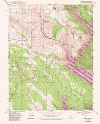
1947 Map of Chinese Camp
USGS Topo · Published 1987About this map
Chinese Camp serves as the focal point of this Mother Lode landscape, situated just north of the expansive Red Hills. The area is defined by its industrial and transport legacies, particularly the winding path of the Sierra Railroad Grade and the engineering of the Hetch Hetchy Aqueduct. Significant mining activity is recorded through features like the Karastulk Mine and Copper Mine, alongside extensive tailings that speak to the region's extraction history.
Find a feature on this map
23 named features on this map. Tap any name to fly to it.
Don’t see what you’re looking for? This feature index may not catch every label — zoom into the map to look around manually.
Map Details
Editions of this 1947 Chinese Camp Map
4 editions found
Other maps of this area

1893 · Sonora
USGS Topo · 1:125,000

1896 · Sonora
USGS Topo · 1:125,000

1897 · Sonora
USGS Topo · 1:125,000

1898 · Sonora
USGS Topo · 1:125,000

1915 · La Grange
USGS Topo · 1:24,000

1916 · Cooperstown
USGS Topo · 1:31,680

1916 · Copperopolis
USGS Topo · 1:62,500

1919 · La Grange
USGS Topo · 1:31,680

1942 · Copperopolis
USGS Topo · 1:62,500

1944 · Merced Falls
USGS Topo · 1:62,500