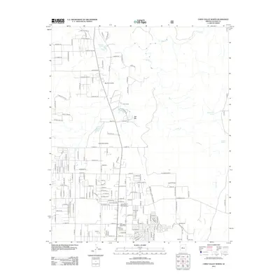
2012 Map of Chino Valley North
USGS Topo · Published 2012About this map
Del Rio Springs and the headwaters of the Verde River anchor this landscape at the northern end of the Chino Valley. The terrain is defined by the convergence of Granite Cr and the river near Sullivan Lake, a critical hydrological junction in this arid region. Settlement is clustered around the Little Chino Valley and Del Rio, showing a transition from ranching heritage to modern administrative and residential footprints. Significant facilities like the Arizona Highway Maintenance Chino Valley Yard and the Chino Valley District Ranger Office reflect the area's role as a regional service hub. Rural infrastructure is further evidenced by landmarks such as Del Rio Ranch and stock-watering points like Boundary Tank and Duck Tank, which dot the more open reaches of the Big Chino Valley.
Find a feature on this map
151 named features on this map. Tap any name to fly to it.
Don’t see what you’re looking for? This feature index may not catch every label — zoom into the map to look around manually.
Map Details
Editions of this 2012 Chino Valley North Map
This is the sole edition of this map. No revisions or reprints were ever made.
Other maps of this area

1887 · Prescott
USGS Topo · 1:250,000

1892 · Prescott
USGS Topo · 1:250,000

1905 · Jerome
USGS Topo · 1:125,000

1947 · Simmons
USGS Topo · 1:62,500

1947 · Iron Springs
USGS Topo · 1:62,500

1947 · Paulden
USGS Topo · 1:62,500

1947 · Prescott
USGS Topo · 1:62,500

1948 · Iron Springs
USGS Topo · 1:63,360

1948 · Prescott
USGS Topo · 1:62,500

1948 · Simmons
USGS Topo · 1:63,360