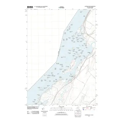
2011 Map of Chippewa Bay
USGS Topo · Published 2011About this map
The Saint Lawrence River serves as the international boundary and primary geographical feature of this region at the start of the 21st century. The complex riverine landscape is defined by an intricate archipelago, where islands such as Jorstadt Island, Oak Island, and the Indian Chief Islands sit among navigational hazards like Indian Chief Shoal and Superior Shoal. Near Schermerhorn Landing, the shoreline is deeply indented by Crooked Creek and numerous small bays, reflecting a pattern of coastal settlement and seasonal use.
Find a feature on this map
100 named features on this map. Tap any name to fly to it.
Don’t see what you’re looking for? This feature index may not catch every label — zoom into the map to look around manually.
Map Details
Editions of this 2011 Chippewa Bay Map
This is the sole edition of this map. No revisions or reprints were ever made.
Other maps of this area

1903 · Alexandria Bay
USGS Topo · 1:62,500

1906 · Brier Hill
USGS Topo · 1:62,500

1912 · Hammond
USGS Topo · 1:62,500

1942 · Morristown
USGS Topo · 1:24,000

1943 · Morristown
USGS Topo · 1:31,680

1943 · Redwood
USGS Topo · 1:31,680

1943 · Alexandria Bay
USGS Topo · 1:31,680

1944 · Hammond
USGS Topo · 1:62,500

1948 · Chippewa Bay
USGS Topo · 1:24,000

1948 · Alexandria Bay
USGS Topo · 1:62,500