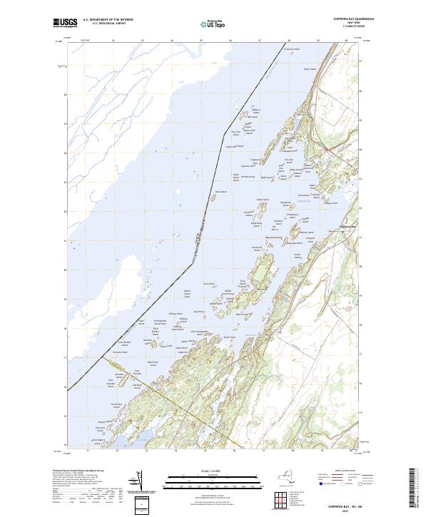
2023 Map of Chippewa Bay
USGS Topo · Published 2023About this map
Chippewa Bay serves as a focal point for this shoreline study, where the Saint Lawrence River creates an intricate archipelago of granite islands and shoals along the international border with Canada. The landscape is defined by its deep maritime character, featuring numerous named landforms like Indian Chief Islands and Peach Island that dot the river channel. Along the New York mainland, the settlement patterns follow the winding path of the river, with Little Hammond Point and Allens Point reaching into the water. Further inland, the terrain is shaped by Crooked Creek and the sheltered waters of Goose Bay, illustrating the transition from the river's main channel to the wetland-rich basins. This documentation tracks the modern road network, including River Rd and Calaboga Rd, that connects these historic riverfront communities.
Find a feature on this map
111 named features on this map. Tap any name to fly to it.
Don’t see what you’re looking for? This feature index may not catch every label — zoom into the map to look around manually.
Map Details
Editions of this 2023 Chippewa Bay Map
This is the sole edition of this map. No revisions or reprints were ever made.
Other maps of this area

1903 · Alexandria Bay
USGS Topo · 1:62,500

1906 · Brier Hill
USGS Topo · 1:62,500

1912 · Hammond
USGS Topo · 1:62,500

1942 · Morristown
USGS Topo · 1:24,000

1943 · Morristown
USGS Topo · 1:31,680

1943 · Redwood
USGS Topo · 1:31,680

1943 · Alexandria Bay
USGS Topo · 1:31,680

1944 · Hammond
USGS Topo · 1:62,500

1948 · Chippewa Bay
USGS Topo · 1:24,000

1948 · Alexandria Bay
USGS Topo · 1:62,500