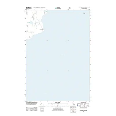
2011 Map of Chippewa Point
USGS Topo · Published 2011About this map
Chippewa Point extends into the meeting waters of Big Bay de Noc and Lake Michigan, characterizing this transition between the Upper Peninsula landmass and the open Great Lakes. The landscape is defined by the hydrologic connection between Granskog Lake and the bay via Granskog Creek, while Indian Town Lake sits further north along the coast. This 2011 survey documents a network of forest roads, including 8036 and 8033, that penetrate the wooded terrain behind the shoreline. The inclusion of Round Island offshore provides a clear reference for the maritime geography of the area, where the vast expanse of Green Bay begins to open to the south. This map is particularly useful for understanding the modern shoreline configuration and the access routes through the remote coastal forests of Delta County.
Find a feature on this map
16 named features on this map. Tap any name to fly to it.
Don’t see what you’re looking for? This feature index may not catch every label — zoom into the map to look around manually.
Map Details
Editions of this 2011 Chippewa Point Map
This is the sole edition of this map. No revisions or reprints were ever made.
Other maps of this area

1932 · Burnt Bluff SW
USGS Topo · 1:31,680

1932 · Burnt Bluff NW
USGS Topo · 1:31,680

1932 · Rapid River SE
USGS Topo · 1:31,680

1932 · Rapid River SW
USGS Topo · 1:31,680

1954 · Escanaba
USGS Topo · 1:250,000

1957 · Escanaba
USGS Topo · 1:250,000

1958 · Escanaba
USGS Topo · 1:250,000

1958 · Garden
USGS Topo · 1:62,500

1958 · Peninsula Point
USGS Topo · 1:62,500

1958 · Fairport
USGS Topo · 1:62,500