
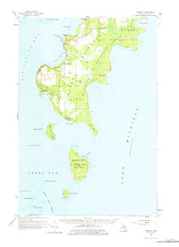
1958 Map of Fairport
USGS Topo · Published 1959About this map
Fayette and the surrounding shores of Big Bay de Noc define this maritime landscape at the southern tip of the Garden Peninsula. In the late 1950s, the area remained a balance of small coastal settlements and expansive timberlands within the Garden State Forest. The map documents a community deeply tied to the water, featuring a chain of islands extending into Green Bay, including Summer Island and the Poverty Island Lighthouse.
Find a feature on this map
50 named features on this map. Tap any name to fly to it.
Don’t see what you’re looking for? This feature index may not catch every label — zoom into the map to look around manually.
Map Details
Editions of this 1958 Fairport Map
2 editions found
Other maps of this area

1932 · Burnt Bluff SW
USGS Topo · 1:31,680

1932 · Burnt Bluff NE
USGS Topo · 1:31,680

1932 · Burnt Bluff NW
USGS Topo · 1:31,680

1932 · Garden SE
USGS Topo · 1:31,680

1932 · Rapid River SE
USGS Topo · 1:31,680

1954 · Escanaba
USGS Topo · 1:250,000

1957 · Escanaba
USGS Topo · 1:250,000

1958 · Escanaba
USGS Topo · 1:250,000

1958 · Cooks
USGS Topo · 1:62,500

1958 · Garden
USGS Topo · 1:62,500