
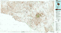
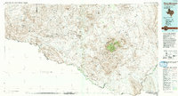
1985 Map of Chisos Mountains
USGS Topo · Published 1985About this map
Big Bend National Park dominates this 1980s landscape, where the Rio Grande carves a sharp international boundary between the United States and the Mexican states of Chihuahua and Coahuila. The terrain is characterized by the high elevations of the Chisos Mountains, including peaks like Emory Peak and Casa Grande Peak, which rise above the surrounding desert floor. This era shows the developed footprint of the park near the Park Headquarters and the distinct, dispersed settlements of the Trans-Pecos region.
Find a feature on this map
98 named features on this map. Tap any name to fly to it.
Don’t see what you’re looking for? This feature index may not catch every label — zoom into the map to look around manually.
Map Details
Editions of this 1985 Chisos Mountains Map
3 editions found
Other maps of this area

1896 · Polvo
USGS Topo · 1:125,000

1896 · Shafter
USGS Topo · 1:125,000

1903 · Chisos Mountains
USGS Topo · 1:125,000

1903 · Terlingua
USGS Topo · 1:125,000

1904 · Terlingua
USGS Topo · 1:125,000

1905 · Chisos Mountains
USGS Topo · 1:125,000

1917 · Agua Fria
USGS Topo · 1:62,500

1917 · Tascotal Mesa
USGS Topo · 1:62,500

1917 · Bone Spring
USGS Topo · 1:62,500

1918 · Bone Spring
USGS Topo · 1:125,000