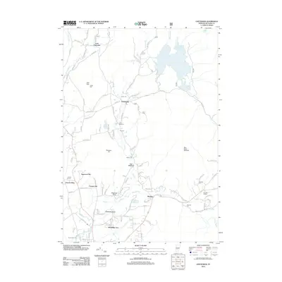
2012 Map of Chittenden
USGS Topo · Published 2012About this map
Chittenden Reservoir and its surrounding highlands anchor this northern Rutland County landscape. The settlement of Chittenden serves as a central hub, while smaller communities like North Chittenden and Mendon are connected by a network of rural roads such as Stoney Hill Rd and Middle Rd. For genealogists, the map is particularly rich in family history markers, including the Horton Cem, Baird Cem, and Eggelston Cem located near the Killington Gateway. The terrain is characterized by prominent peaks like Bald Peak and Sugarwood Hill, overlooking recreation areas such as Camp Sangamon and the Rutland Golf Course. The drainage patterns of East Cr and Mendon Brook illustrate how water resources were managed through both natural ponds like Lefferts Pond and the Rutland City Reservoir.
Find a feature on this map
104 named features on this map. Tap any name to fly to it.
Don’t see what you’re looking for? This feature index may not catch every label — zoom into the map to look around manually.
Map Details
Editions of this 2012 Chittenden Map
This is the sole edition of this map. No revisions or reprints were ever made.
Other maps of this area

1891 · Rutland
USGS Topo · 1:62,500

1893 · Rutland
USGS Topo · 1:62,500

1895 · Castleton
USGS Topo · 1:62,500

1897 · Castleton
USGS Topo · 1:62,500

1902 · Brandon
USGS Topo · 1:62,500

1904 · Brandon
USGS Topo · 1:62,500

1915 · Rochester
USGS Topo · 1:62,500

1917 · Rochester
USGS Topo · 1:62,500

1920 · Brandon
USGS Topo · 1:62,500

1944 · Proctor
USGS Topo · 1:31,680