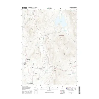
2015 Map of Chittenden
USGS Topo · Published 2015About this map
The Chittenden Reservoir dominates the high terrain of the Green Mountains, surrounded by the protected lands of the Green Mountain National Forest. This 2015 topography reveals a landscape where historical burial grounds such as Horton Cem, Baird Cem, and Eggelston Cem are tucked into the foothills and along the winding courses of Furnace Brook and Mendon Brook. The map illustrates a clear distinction between the rugged, forested uplands and the increasing residential development in the valleys.
Find a feature on this map
88 named features on this map. Tap any name to fly to it.
Don’t see what you’re looking for? This feature index may not catch every label — zoom into the map to look around manually.
Map Details
Editions of this 2015 Chittenden Map
This is the sole edition of this map. No revisions or reprints were ever made.
Other maps of this area

1891 · Rutland
USGS Topo · 1:62,500

1893 · Rutland
USGS Topo · 1:62,500

1895 · Castleton
USGS Topo · 1:62,500

1897 · Castleton
USGS Topo · 1:62,500

1902 · Brandon
USGS Topo · 1:62,500

1904 · Brandon
USGS Topo · 1:62,500

1915 · Rochester
USGS Topo · 1:62,500

1917 · Rochester
USGS Topo · 1:62,500

1920 · Brandon
USGS Topo · 1:62,500

1944 · Proctor
USGS Topo · 1:31,680