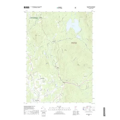
2018 Map of Chittenden
USGS Topo · Published 2018About this map
Chittenden Reservoir dominates the northern reaches of this Vermont landscape, situated within the expansive Green Mountain National Forest. This modern topographical study illustrates the intricate watershed of Rutland County, where the Rutland City Reservoir and Lefferts Pond are fed by numerous mountain streams like Hewitt Brook and Billings Brook. The terrain transitions from the high peaks of Blue Ridge Mtn and Bald Peak down toward the northern edge of Rutland.
Find a feature on this map
103 named features on this map. Tap any name to fly to it.
Don’t see what you’re looking for? This feature index may not catch every label — zoom into the map to look around manually.
Map Details
Editions of this 2018 Chittenden Map
This is the sole edition of this map. No revisions or reprints were ever made.
Other maps of this area

1891 · Rutland
USGS Topo · 1:62,500

1893 · Rutland
USGS Topo · 1:62,500

1895 · Castleton
USGS Topo · 1:62,500

1897 · Castleton
USGS Topo · 1:62,500

1902 · Brandon
USGS Topo · 1:62,500

1904 · Brandon
USGS Topo · 1:62,500

1915 · Rochester
USGS Topo · 1:62,500

1917 · Rochester
USGS Topo · 1:62,500

1920 · Brandon
USGS Topo · 1:62,500

1944 · Proctor
USGS Topo · 1:31,680