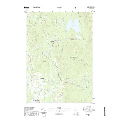
2021 Map of Chittenden
USGS Topo · Published 2021About this map
Green Mountain National Forest dominates the eastern half of this landscape, where the Blue Ridge Mtn and the Green Mountains define a high-elevation backcountry. This terrain is marked by a complex network of forest roads and trails, including the Deer Run Trl and Hewitt Brook Trl, which navigate the slopes surrounding Chittenden Reservoir. In the lower elevations to the west, the Dwight D Eisenhower National Fish Hatchery is a prominent federal installation near North Chittenden.
Find a feature on this map
112 named features on this map. Tap any name to fly to it.
Don’t see what you’re looking for? This feature index may not catch every label — zoom into the map to look around manually.
Map Details
Editions of this 2021 Chittenden Map
This is the sole edition of this map. No revisions or reprints were ever made.
Other maps of this area

1891 · Rutland
USGS Topo · 1:62,500

1893 · Rutland
USGS Topo · 1:62,500

1895 · Castleton
USGS Topo · 1:62,500

1897 · Castleton
USGS Topo · 1:62,500

1902 · Brandon
USGS Topo · 1:62,500

1904 · Brandon
USGS Topo · 1:62,500

1915 · Rochester
USGS Topo · 1:62,500

1917 · Rochester
USGS Topo · 1:62,500

1920 · Brandon
USGS Topo · 1:62,500

1944 · Proctor
USGS Topo · 1:31,680