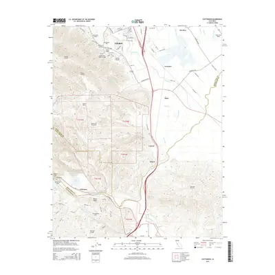
2015 Map of Chittenden
USGS Topo · Published 2015About this map
The San Andreas Fault cuts through this landscape where the Santa Cruz Mountains meet the Santa Clara Valley, defining the structural geology of the region. The map captures the southern edge of Gilroy and the historic site of Old Gilroy, along with the transition into the Lomerias Muertas hills. This area serves as a significant drainage junction where Uvas Creek and Llagas Creek converge into Carnadero Cr, which eventually meets the Pajaro River near the Chittenden Pass.
Find a feature on this map
86 named features on this map. Tap any name to fly to it.
Don’t see what you’re looking for? This feature index may not catch every label — zoom into the map to look around manually.
Map Details
Editions of this 2015 Chittenden Map
This is the sole edition of this map. No revisions or reprints were ever made.
Other maps of this area

1915 · San Juan Bautista
USGS Topo · 1:48,000

1917 · Morgan Hill
USGS Topo · 1:62,500

1917 · San Juan Bautista
USGS Topo · 1:62,500

1919 · Hollister
USGS Topo · 1:48,000

1921 · Gilroy Hot Springs
USGS Topo · 1:62,500

1921 · Hollister
USGS Topo · 1:62,500

1923 · Hollister
USGS Topo · 1:62,500

1939 · Morgan Hill
USGS Topo · 1:62,500

1939 · Gilroy Hot Springs
USGS Topo · 1:62,500

1939 · San Juan Bautista
USGS Topo · 1:62,500