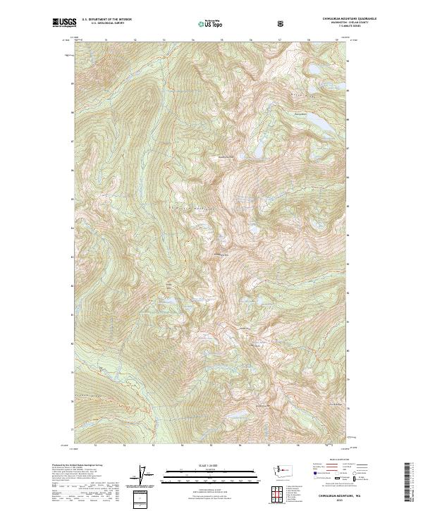
2023 Map of Chiwaukum Mountains
USGS Topo · Published 2023About this map
The Chiwaukum Mountains dominate this high-elevation landscape within the Wenatchee National Forest and the Alpine Lakes Wilderness. A network of alpine basins contains numerous water bodies, including Loch Eileen, Lake Donald, and the Jason Lakes below McCue Ridge. The terrain is defined by sharp elevation changes at Snowgrass Mtn and Grindstone Mtn, connected by high-altitude crossings like Frosty Pass and Ladies Pass.
Find a feature on this map
63 named features on this map. Tap any name to fly to it.
Don’t see what you’re looking for? This feature index may not catch every label — zoom into the map to look around manually.
Map Details
Editions of this 2023 Chiwaukum Mountains Map
This is the sole edition of this map. No revisions or reprints were ever made.
Other maps of this area

1901 · Chiwaukum
USGS Topo · 1:125,000

1902 · Skykomish
USGS Topo · 1:125,000

1904 · Chiwaukum
USGS Topo · 1:125,000

1905 · Skykomish
USGS Topo · 1:125,000

1957 · Wenatchee
USGS Topo · 1:250,000

1965 · Chiwaukum Mts
USGS Topo · 1:62,500

1965 · Stevens Pass
USGS Topo · 1:24,000

1965 · Wenatchee Lake
USGS Topo · 1:62,500
1965 · The Cradle
USGS Topo · 1:24,000
1965 · Labyrinth Mtn
USGS Topo · 1:24,000