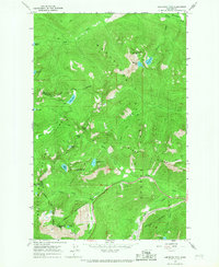
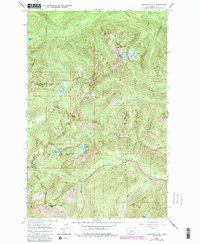
1965 Map of Labyrinth Mtn
USGS Topo · Published 1967About this map
The Great Northern Tunnel and its predecessor, the Great Northern Tunnel (Abandoned), dominate the southern portion of this high-altitude landscape where Chelan, Snohomish, and King counties meet. This 1965 survey documents the critical transportation corridor over the Cascades, centered on the Stevens Pass Hwy and its associated Ski Lift facilities. The map traces the winding route of the Pacific Crest National Scenic Trail as it traverses high ridges between alpine water bodies like Lake Janus and Valhalla Lake. The rugged crest is punctuated by peaks such as Labyrinth Mtn and Lichtenberg Mtn, overlooking deep basins drained by the Little Wenatchee River and Nason Creek. This map is particularly valuable for documenting the transition of the Great Northern railway infrastructure and the early development of the pass as a recreation destination.
Find a feature on this map
39 named features on this map. Tap any name to fly to it.
Don’t see what you’re looking for? This feature index may not catch every label — zoom into the map to look around manually.
Map Details
Editions of this 1965 Labyrinth Mtn Map
5 editions found
Other maps of this area

1901 · Chiwaukum
USGS Topo · 1:125,000

1902 · Skykomish
USGS Topo · 1:125,000

1904 · Chiwaukum
USGS Topo · 1:125,000

1905 · Skykomish
USGS Topo · 1:125,000

1957 · Wenatchee
USGS Topo · 1:250,000

1965 · Captain Point
USGS Topo · 1:24,000

1965 · Chiwaukum Mts
USGS Topo · 1:62,500

1965 · Stevens Pass
USGS Topo · 1:24,000

1965 · Wenatchee Lake
USGS Topo · 1:62,500

1965 · Poe Mountain
USGS Topo · 1:24,000