
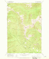
1965 Map of Poe Mountain
USGS Topo · Published 1967About this map
Wenatchee National Forest and the Glacier Peak Wilderness define this high-elevation landscape as it was documented in the mid-1960s. The terrain is structured by the Little Wenatchee River and a dense network of tributaries including Indian Creek, Cougar Creek, and Fish Creek. Settlement is limited to recreational outposts like the Little Wenatchee Ford Campground and Lake Creek Campground, reflecting a transition toward managed conservation and recreation in the Cascades. Significant peaks such as Poe Mountain, Whittier Peak, and Mount Jonathan anchor the ridgelines, while historic access is provided by an extensive trail system. These paths, such as the Cady Ridge Trail and Indian Creek Trail, follow natural corridors through Indian Pass and high alpine areas like Meander Meadow, marking the traditional routes used by surveyors and early backcountry travelers before modern road development reached these interior basins.
Find a feature on this map
42 named features on this map. Tap any name to fly to it.
Don’t see what you’re looking for? This feature index may not catch every label — zoom into the map to look around manually.
Map Details
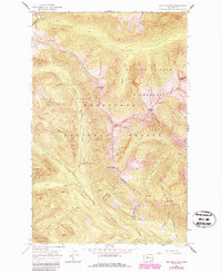
Editions of this 1965 Poe Mountain Map
3 editions found
Other maps of this area

1899 · Glacier Peak
USGS Topo · 1:125,000

1901 · Glacier Peak
USGS Topo · 1:125,000

1901 · Chiwaukum
USGS Topo · 1:125,000

1902 · Skykomish
USGS Topo · 1:125,000

1902 · Stehekin
USGS Topo · 1:125,000

1904 · Stehekin
USGS Topo · 1:125,000

1904 · Chiwaukum
USGS Topo · 1:125,000

1905 · Skykomish
USGS Topo · 1:125,000

1944 · Holden
USGS Topo · 1:62,500

1949 · Holden
USGS Topo · 1:62,500