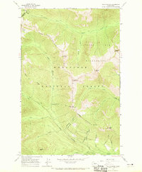
1965 Map of Poe Mountain
USGS Topo · Published 1970About this map
The high alpine intersection of the Wenatchee National Forest and Mt Baker National Forest defines this 1965 field-checked survey. Central to the landscape is the Little Wenatchee River, which flows through a series of numbered tributaries including Twelvemile Creek and Thirteenmile Creek. The terrain is characterized by prominent summits like Poe Mountain and Longfellow Mtn, joined by the extensive Cady Ridge.
Find a feature on this map
36 named features on this map. Tap any name to fly to it.
Don’t see what you’re looking for? This feature index may not catch every label — zoom into the map to look around manually.
Map Details
Editions of this 1965 Poe Mountain Map
3 editions found

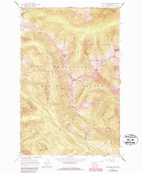
Other maps of this area

1899 · Glacier Peak
USGS Topo · 1:125,000

1901 · Glacier Peak
USGS Topo · 1:125,000

1901 · Chiwaukum
USGS Topo · 1:125,000

1902 · Skykomish
USGS Topo · 1:125,000

1902 · Stehekin
USGS Topo · 1:125,000

1904 · Stehekin
USGS Topo · 1:125,000

1904 · Chiwaukum
USGS Topo · 1:125,000

1905 · Skykomish
USGS Topo · 1:125,000

1944 · Holden
USGS Topo · 1:62,500

1949 · Holden
USGS Topo · 1:62,500