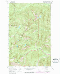
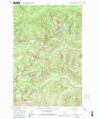
1965 Map of Labyrinth Mtn
USGS Topo · Published 1987About this map
Stevens Pass serves as the focal point of this high-altitude landscape, where the borders of Chelan, Snohomish, and King counties converge. The 1965 survey, updated in the late 1980s, highlights the critical transportation corridor provided by the Burlington Northern (Cascade Tunnel) and the Pacific Crest National Scenic Trail. This area is defined by its collection of alpine lakes, including Minotaur Lake, Theseus Lake, and the remote Valhalla Lake, all situated within the sprawling reaches of the Wenatchee National Forest and Mt. Baker National Forest. High peaks like Labyrinth Mtn. and Lichtenberg Mtn. loom over the drainage basins of Nason Creek and the Little Wenatchee River, illustrating the complex hydrological network at the crest of the Cascades before the modern expansion of recreational infrastructure.
Find a feature on this map
38 named features on this map. Tap any name to fly to it.
Don’t see what you’re looking for? This feature index may not catch every label — zoom into the map to look around manually.
Map Details
Editions of this 1965 Labyrinth Mtn Map
5 editions found
Other maps of this area

1901 · Chiwaukum
USGS Topo · 1:125,000

1902 · Skykomish
USGS Topo · 1:125,000

1904 · Chiwaukum
USGS Topo · 1:125,000

1905 · Skykomish
USGS Topo · 1:125,000

1957 · Wenatchee
USGS Topo · 1:250,000

1965 · Captain Point
USGS Topo · 1:24,000

1965 · Chiwaukum Mts
USGS Topo · 1:62,500

1965 · Stevens Pass
USGS Topo · 1:24,000

1965 · Wenatchee Lake
USGS Topo · 1:62,500

1965 · Poe Mountain
USGS Topo · 1:24,000