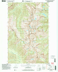
2004 Map of Chiwaukum Mountains
USGS Topo · Published 2008About this map
Alpine Lakes Wilderness and the Wenatchee National Forest dominate this high-elevation landscape within the Chiwaukum Mountains. The topography is defined by sharp peaks and deep glacial basins, where numerous high-country lakes such as Lake Charles, Larch Lake, and Chiwaukum Lake serve as the headwaters for the drainage network of Whitepine Creek and Chiwaukum Creek. This 2004 revision reflects the modern boundaries of protected wilderness areas and the established trail network connecting significant gaps like Frosty Pass, Ladies Pass, and Deadhorse Pass.
Find a feature on this map
51 named features on this map. Tap any name to fly to it.
Don’t see what you’re looking for? This feature index may not catch every label — zoom into the map to look around manually.
Map Details
Editions of this 2004 Chiwaukum Mountains Map
This is the sole edition of this map. No revisions or reprints were ever made.
Other maps of this area

1901 · Chiwaukum
USGS Topo · 1:125,000

1902 · Skykomish
USGS Topo · 1:125,000

1904 · Chiwaukum
USGS Topo · 1:125,000

1905 · Skykomish
USGS Topo · 1:125,000

1957 · Wenatchee
USGS Topo · 1:250,000

1965 · Chiwaukum Mts
USGS Topo · 1:62,500

1965 · Stevens Pass
USGS Topo · 1:24,000

1965 · Wenatchee Lake
USGS Topo · 1:62,500
1965 · The Cradle
USGS Topo · 1:24,000
1965 · Labyrinth Mtn
USGS Topo · 1:24,000