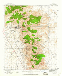
1939 Map of Chloride
USGS Topo · Published 1961About this map
Chloride serves as the focal point for this high-desert landscape, reflecting its origins as a silver mining hub within the Cerbat Mountains. Surveyed in 1939 by Lawrence Hankins and others, the map records a rugged industrial economy where the USLM 4400 Tennessee Mine and Arizona Magma Mine dominate the local geography. Beyond the main town, smaller settlements and homesteads like Mineral Park and Barksdale Ranch are scattered along the mountain fringes, while the curious inclusion of Santa Claus appears along the highway in the Sacramento Valley. The landscape is characterized by a dense network of canyons and peaks, including Cherum Pk and Turquoise Mtn, interspersed with vital water sources such as Cedar Spr and Gaddis Spr that sustained the region's mines and ranches.
Find a feature on this map
52 named features on this map. Tap any name to fly to it.
Don’t see what you’re looking for? This feature index may not catch every label — zoom into the map to look around manually.
Map Details
Editions of this 1939 Chloride Map
3 editions found
Other maps of this area

1886 · Diamond Creek
USGS Topo · 1:250,000

1886 · Camp Mohave
USGS Topo · 1:250,000

1892 · Diamond Creek
USGS Topo · 1:250,000

1892 · Camp Mohave
USGS Topo · 1:250,000

1939 · Chloride
USGS Topo · 1:48,000

1942 · Camp Mohave
USGS Topo · 1:250,000

1944 · Chloride
USGS Topo · 1:62,500

1947 · Kingman
USGS Topo · 1:250,000

1948 · Kingman
USGS Topo · 1:250,000

1948 · Williams
USGS Topo · 1:250,000