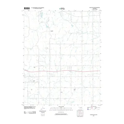
2010 Map of Chouteau NW
USGS Topo · Published 2010About this map
Scaly Bark Mountain and Timber Ridge rise above the agricultural plains of Rogers County in this 2010 survey. The landscape is defined by a dense grid of rural roads like S 4230 RD and E 540 RD, connecting scattered homesteads across a territory drained by Chouteau Creek and Bull Creek. For genealogists and local historians, the map identifies specific community landmarks including Highland Cemetery and the Brethren Cemetery. Aviation history is represented by the Buzzards Roost Airport located near Inola Hill. The drainage patterns of Brush Creek and Pea Creek reflect the natural hydrology of the region before the encroachment of modern suburban development, preserving a view of the area's rural character at the start of the 21st century.
Find a feature on this map
32 named features on this map. Tap any name to fly to it.
Don’t see what you’re looking for? This feature index may not catch every label — zoom into the map to look around manually.
Map Details
Editions of this 2010 Chouteau NW Map
This is the sole edition of this map. No revisions or reprints were ever made.
Other maps of this area

1896 · Pryor
USGS Topo · 1:125,000

1901 · Claremore
USGS Topo · 1:125,000

1901 · Pryor
USGS Topo · 1:125,000

1914 · Claremore
USGS Topo · 1:125,000

1916 · Claremore
USGS Topo · 1:125,000

1954 · Tulsa
USGS Topo · 1:250,000

1958 · Tulsa
USGS Topo · 1:250,000

1963 · Tulsa
USGS Topo · 1:250,000
1963 · Neodesha
USGS Topo · 1:24,000
1963 · Claremore
USGS Topo · 1:24,000