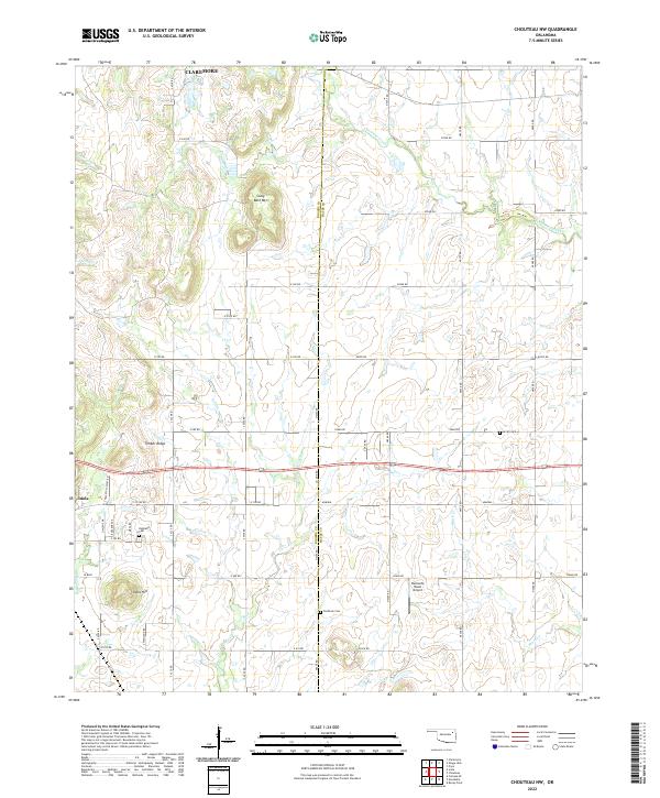
2022 Map of Chouteau NW
USGS Topo · Published 2022About this map
Rogers and Mayes counties meet in this 2022 survey of a landscape defined by rolling prairie and small, persistent watercourses. The northeastern reach of Inola and the southern edge of Claremore anchor the sheet, while the rural interior is dotted with legacy family and community landmarks. Notable for genealogists are three distinct burial grounds—Highland Cem, Amish Cem, and Brethren Cem—which point to the diverse religious settlement history of the Oklahoma countryside.
Find a feature on this map
46 named features on this map. Tap any name to fly to it.
Don’t see what you’re looking for? This feature index may not catch every label — zoom into the map to look around manually.
Map Details
Editions of this 2022 Chouteau NW Map
This is the sole edition of this map. No revisions or reprints were ever made.
Other maps of this area

1896 · Pryor
USGS Topo · 1:125,000

1901 · Claremore
USGS Topo · 1:125,000

1901 · Pryor
USGS Topo · 1:125,000

1914 · Claremore
USGS Topo · 1:125,000

1916 · Claremore
USGS Topo · 1:125,000

1954 · Tulsa
USGS Topo · 1:250,000

1958 · Tulsa
USGS Topo · 1:250,000

1963 · Tulsa
USGS Topo · 1:250,000
1963 · Neodesha
USGS Topo · 1:24,000
1963 · Claremore
USGS Topo · 1:24,000