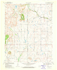
1970 Map of Chouteau NW
USGS Topo · Published 1972About this map
Scaly Bark Mountain rises as a prominent landmark above the surrounding prairie and creek bottoms in this 1970 snapshot of the Rogers and Mayes County border. The landscape is defined by the transition from upland ridges like Timber Ridge and Inola Hill down to the meandering paths of Chouteau Creek and Bull Creek. The map documents a sparsely populated but deeply rooted community, evidenced by several scattered burial grounds and spiritual centers such as the Amish Cem, Highland Cem, and Brethren Cem, alongside the Eden Ch.
Find a feature on this map
20 named features on this map. Tap any name to fly to it.
Don’t see what you’re looking for? This feature index may not catch every label — zoom into the map to look around manually.
Map Details
Editions of this 1970 Chouteau NW Map
This is the sole edition of this map. No revisions or reprints were ever made.
Other maps of this area

1896 · Pryor
USGS Topo · 1:125,000

1901 · Claremore
USGS Topo · 1:125,000

1901 · Pryor
USGS Topo · 1:125,000

1914 · Claremore
USGS Topo · 1:125,000

1916 · Claremore
USGS Topo · 1:125,000

1954 · Tulsa
USGS Topo · 1:250,000

1958 · Tulsa
USGS Topo · 1:250,000

1963 · Tulsa
USGS Topo · 1:250,000
1963 · Neodesha
USGS Topo · 1:24,000
1963 · Claremore
USGS Topo · 1:24,000