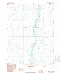
1990 Map of Christian A-1
USGS Topo · Published 1990About this map
The Sheenjek River winds through the heart of this Alaskan interior landscape, displaying an intricate braided channel and numerous oxbow lakes characteristic of the region. This portion of the Yukon Flats National Wildlife Refuge is defined by a complex network of wetlands and seasonal ponds, providing a detailed record of the shifting riverbed and hydrology in the late 20th century. Surveyed by the U.S. Geological Survey using photography from the late 1970s and early 1980s, the map provides a precision study of this roadless environment. Researchers can observe how the river system continuously reshapes the basin, creating a dynamic environment for local wildlife and traditional land use within the refuge boundaries.
Find a feature on this map
3 named features on this map. Tap any name to fly to it.
Don’t see what you’re looking for? This feature index may not catch every label — zoom into the map to look around manually.
Map Details
Editions of this 1990 Christian A-1 Map
This is the sole edition of this map. No revisions or reprints were ever made.
Other maps of this area

1951 · Fort Yukon
USGS Topo · 1:250,000

1951 · Black River
USGS Topo · 1:250,000

1951 · Coleen
USGS Topo · 1:250,000

1951 · Christian
USGS Topo · 1:250,000

1955 · Fort Yukon D-2
USGS Topo · 1:63,360

1956 · Coleen
USGS Topo · 1:250,000

1956 · Black River D-6
USGS Topo · 1:63,360
1956 · Coleen A-6
USGS Topo · 1:63,360
1956 · Fort Yukon D-1
USGS Topo · 1:63,360

1956 · Christian
USGS Topo · 1:250,000