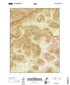
2018 Map of Christian B-2 NW
USGS Topo · Published 2018About this map
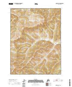
Thluichohnjik Cr meanders through the high elevations of the Yukon-Koyukuk region, providing the primary drainage for this stretch of the Alaskan interior. This 2018 survey emphasizes the extreme relief of the Brooks Range foothills, where steep ridgelines and deep basins dictate the flow of the local water network. The map detail reflects the Public Land Survey System grids for Townships 31 North, Range 12 East, 31 North, Range 13 East, 30 North, Range 12 East, and 30 North, Range 13 East, illustrating a landscape defined by natural topography rather than human settlement. The absence of roads or structures highlights the isolation of this Arctic wilderness during the early 21st century.
Find a feature on this map
5 named features on this map. Tap any name to fly to it.
Don’t see what you’re looking for? This feature index may not catch every label — zoom into the map to look around manually.
Map Details
Editions of this 2018 Christian B-2 NW Map
This is the sole edition of this map. No revisions or reprints were ever made.
Other maps of this area

1951 · Christian
USGS Topo · 1:250,000

1956 · Christian
USGS Topo · 1:250,000
1972 · Christian C-3
USGS Topo · 1:63,360
1983 · Christian C-3
USGS Topo · 1:63,360
1983 · Christian C-2
USGS Topo · 1:63,360
1990 · Christian B-3
USGS Topo · 1:63,360
1990 · Christian B-2
USGS Topo · 1:63,360
2018 · Christian C-2 SW
USGS Topo · 1:25,000
2018 · Christian B-2 SW
USGS Topo · 1:25,000
2018 · Christian C-2 SE
USGS Topo · 1:25,000