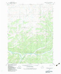
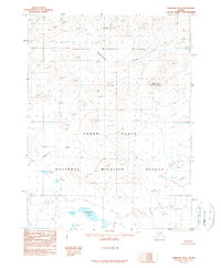
1983 Map of Christian C-3
USGS Topo · Published 1983About this map
The Venetie Indian Reservation occupies much of this northern Alaskan landscape, where the Christian River meanders across the lower elevations. In the early 1980s, this area remained largely remote, characterized by the lack of permanent roads and the presence of a seasonal Winter Trail cutting through the interior. The eastern portion of the quadrangle transition into the Arctic National Wildlife Refuge, indicating a region managed for conservation and indigenous land use. Along the southern reaches, Otter Creek flows through the hills, providing a primary drainage for the surrounding terrain. The absence of established townsites or commercial infrastructure reflects a landscape dedicated to traditional subsistence and wilderness preservation during this era.
Find a feature on this map
5 named features on this map. Tap any name to fly to it.
Don’t see what you’re looking for? This feature index may not catch every label — zoom into the map to look around manually.
Map Details
Editions of this 1983 Christian C-3 Map
This is the sole edition of this map. No revisions or reprints were ever made.
Other maps of this area

1951 · Christian
USGS Topo · 1:250,000

1956 · Christian
USGS Topo · 1:250,000
1972 · Christian D-2
USGS Topo · 1:63,360
1972 · Christian D-3
USGS Topo · 1:63,360
1972 · Christian C-3
USGS Topo · 1:63,360
1983 · Christian C-2
USGS Topo · 1:63,360
1990 · Christian C-4
USGS Topo · 1:63,360
1990 · Christian B-3
USGS Topo · 1:63,360
1990 · Christian D-4
USGS Topo · 1:63,360
1990 · Christian B-2
USGS Topo · 1:63,360