
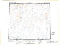
1951 Map of Christian
USGS Topo · Published 1952About this map
The Chandalar River and its various tributaries define this mid-century interior landscape, where the northern reaches of the Yukon Flats meet the rising foothills. This reconnaissance survey, compiled from 1920s ground work and 1940s photography, documents a period when local navigation relied heavily on seasonal movement. The presence of the Winter Trail stretching north toward the Koness River suggests the essential role of overland paths in connecting isolated outposts like Christian and Venetie.
Find a feature on this map
15 named features on this map. Tap any name to fly to it.
Don’t see what you’re looking for? This feature index may not catch every label — zoom into the map to look around manually.
Map Details
Editions of this 1951 Christian Map
2 editions found
Other maps of this area

1951 · Fort Yukon
USGS Topo · 1:250,000

1951 · Black River
USGS Topo · 1:250,000

1951 · Coleen
USGS Topo · 1:250,000

1951 · Chandalar
USGS Topo · 1:250,000

1951 · Brooks
USGS Topo · 1:250,000

1951 · Beaver
USGS Topo · 1:250,000

1951 · Arctic
USGS Topo · 1:250,000

1951 · Table Mountain
USGS Topo · 1:250,000

1955 · Fort Yukon D-2
USGS Topo · 1:63,360

1955 · Fort Yukon D-3
USGS Topo · 1:63,360