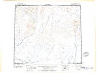
1951 Map of Christian
USGS Topo · Published 1956About this map
The Chandalar River system dominates this mid-century reconnaissance, flowing through a landscape defined by the expansive Yukon Flats and the convergence of the East Fork Chandalar River. This territory, mapped during the post-war era using trimetrogon photography, shows the sparse footprint of human activity in the Alaskan interior. The settlement of Venetie sits along the southern waterway, while the remote location of Christian and a lone Cabin are connected only by a Winter Trail through the valley. To the east, the Sheenjek River flows past Outlook Point near the base of Helmet Mtn. The map preserves the geography of the Brooks Range foothills before modern development, recording a network of named drainages like Wind River and Smoke Creek that supported the seasonal travel and subsistence patterns of the region.
Find a feature on this map
15 named features on this map. Tap any name to fly to it.
Don’t see what you’re looking for? This feature index may not catch every label — zoom into the map to look around manually.
Map Details
Editions of this 1951 Christian Map
2 editions found
Other maps of this area

1951 · Fort Yukon
USGS Topo · 1:250,000

1951 · Black River
USGS Topo · 1:250,000

1951 · Coleen
USGS Topo · 1:250,000

1951 · Chandalar
USGS Topo · 1:250,000

1951 · Christian
USGS Topo · 1:250,000

1951 · Brooks
USGS Topo · 1:250,000

1951 · Beaver
USGS Topo · 1:250,000

1951 · Arctic
USGS Topo · 1:250,000

1951 · Table Mountain
USGS Topo · 1:250,000

1955 · Fort Yukon D-2
USGS Topo · 1:63,360