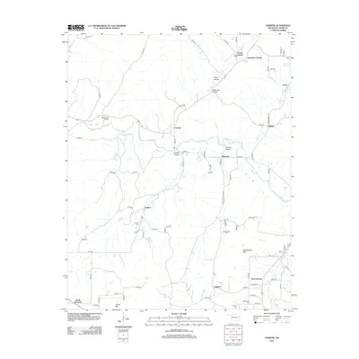
2012 Map of Christie
USGS Topo · Published 2012About this map
The Baron Fork and its numerous tributaries, including Peacheater Cr and Green Cr, define the landscape of this corner of Adair County. Small communities and named hollows are scattered throughout the terrain, with Christie and Addielee serving as primary local landmarks. The area is particularly rich in family-named sites, suggesting a deep genealogical history tied to the land. Prominent elevations such as Spade Mountain and Walkingstick Mtn overlook a series of family burial grounds, including the Walkingstick Cem, Wolf Cem, and Reece Cem. This 2012 survey captures the rural character of the region, where infrastructure like the Westville Reservoir and a network of county roads connect the disparate settlements of West Peavine and England.
Find a feature on this map
76 named features on this map. Tap any name to fly to it.
Don’t see what you’re looking for? This feature index may not catch every label — zoom into the map to look around manually.
Map Details
Editions of this 2012 Christie Map
This is the sole edition of this map. No revisions or reprints were ever made.
Other maps of this area

1898 · Tahlequah
USGS Topo · 1:125,000

1899 · Siloam Springs
USGS Topo · 1:125,000

1901 · Tahlequah
USGS Topo · 1:125,000

1903 · Siloam Springs
USGS Topo · 1:125,000

1904 · Siloam Springs
USGS Topo · 1:125,000

1905 · Tahlequah
USGS Topo · 1:125,000

1946 · Fort Smith
USGS Topo · 1:250,000

1954 · Tulsa
USGS Topo · 1:250,000

1958 · Tulsa
USGS Topo · 1:250,000

1963 · Tulsa
USGS Topo · 1:250,000