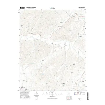
2016 Map of Christie
USGS Topo · Published 2016About this map
Spade Mountain and its namesake Spade Mountain Cem anchor the southwest corner of this Ozark plateau landscape, where high ridges are deeply etched by narrow hollows and creeks. The primary drainage of the Baron Fork cuts through the center, connecting settlements like Proctor and Christie along the highway corridor. For local historians, this survey preserves a dense network of family-named burial grounds and small communities, including Whitmire, Wauhillau, and West Peavine, reflecting the rural settlement patterns of eastern Oklahoma. The topography is defined by significant features like Walkingstick Mtn and numerous drainages such as Peacheater Cr and Peavine Cr. Modern water management is visible in the Westville Reservoir and specialized catchments like Scraper Hollow Creek Site 1 Reservoir, which illustrate the region's adaptation to the terrain.
Find a feature on this map
73 named features on this map. Tap any name to fly to it.
Don’t see what you’re looking for? This feature index may not catch every label — zoom into the map to look around manually.
Map Details
Editions of this 2016 Christie Map
This is the sole edition of this map. No revisions or reprints were ever made.
Other maps of this area

1898 · Tahlequah
USGS Topo · 1:125,000

1899 · Siloam Springs
USGS Topo · 1:125,000

1901 · Tahlequah
USGS Topo · 1:125,000

1903 · Siloam Springs
USGS Topo · 1:125,000

1904 · Siloam Springs
USGS Topo · 1:125,000

1905 · Tahlequah
USGS Topo · 1:125,000

1946 · Fort Smith
USGS Topo · 1:250,000

1954 · Tulsa
USGS Topo · 1:250,000

1958 · Tulsa
USGS Topo · 1:250,000

1963 · Tulsa
USGS Topo · 1:250,000