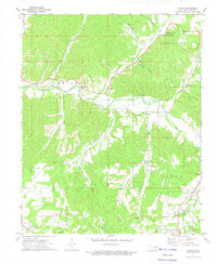
1972 Map of Christie
USGS Topo · Published 1974About this map
The Baron Fork meanders through this portion of Adair County, shaping a landscape of deep hollows and family-named ridges during the early 1970s. The settlement of Christie serves as a central point, supported by the Christie Ch and nearby Community Hall. The geography is defined by significant elevations like Walkingstick Mountain and Spade Mountain, which overlook a network of rural homesteads and burial grounds including Walkingstick Cem, Wolf Cem, and Scraper Cem.
Find a feature on this map
44 named features on this map. Tap any name to fly to it.
Don’t see what you’re looking for? This feature index may not catch every label — zoom into the map to look around manually.
Map Details
Editions of this 1972 Christie Map
This is the sole edition of this map. No revisions or reprints were ever made.
Other maps of this area

1898 · Tahlequah
USGS Topo · 1:125,000

1899 · Siloam Springs
USGS Topo · 1:125,000

1901 · Tahlequah
USGS Topo · 1:125,000

1903 · Siloam Springs
USGS Topo · 1:125,000

1904 · Siloam Springs
USGS Topo · 1:125,000

1905 · Tahlequah
USGS Topo · 1:125,000

1946 · Fort Smith
USGS Topo · 1:250,000

1954 · Tulsa
USGS Topo · 1:250,000

1958 · Tulsa
USGS Topo · 1:250,000

1963 · Tulsa
USGS Topo · 1:250,000