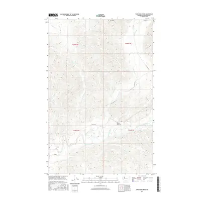
2017 Map of Christmas Creek
USGS Topo · Published 2017About this map
The Olympic Mountains dominate the eastern reach of this Jefferson County landscape, where the Snahapish River and Christmas Creek carve through the high terrain. In the lower elevations, the Clearwater River snakes across the southwestern corner, marked by river navigation points like Rocky Rapids and Crooks Rapids. This 2017 survey details a region defined by its timber and water resources, evidenced by the extensive logging road network of the Hoh Mainline and Clearwater Rd. The map illustrates the complex drainage system of the Hoh and Clearwater basins, including Nolan Cr, Miller Cr, and Shale Cr, while highlighting prominent summits like Mt Octopus. The landscape is largely structured around township and range lines, such as t26n r12w, illustrating the modern management of this Washington wilderness.
Find a feature on this map
25 named features on this map. Tap any name to fly to it.
Don’t see what you’re looking for? This feature index may not catch every label — zoom into the map to look around manually.
Map Details
Editions of this 2017 Christmas Creek Map
This is the sole edition of this map. No revisions or reprints were ever made.
Other maps of this area

1939 · Forks
USGS Topo · 1:62,500

1943 · Spruce Mountain
USGS Topo · 1:62,500

1943 · Copalis Beach
USGS Topo · 1:250,000

1951 · Copalis Beach
USGS Topo · 1:250,000

1956 · Destruction Island
USGS Topo · 1:62,500

1956 · Spruce Mtn.
USGS Topo · 1:62,500

1956 · Salmon River
USGS Topo · 1:62,500

1957 · Forks
USGS Topo · 1:62,500

1957 · Copalis Beach
USGS Topo · 1:250,000

1963 · Copalis Beach
USGS Topo · 1:250,000