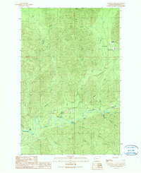
1990 Map of Christmas Creek
USGS Topo · Published 1990About this map
Mount Octopus looms over a landscape defined by the convergence of the Snahapish River and the Clearwater River in this 1990 provisional survey. The area is characterized by its heavy timber management and state infrastructure, notably housing the Olympic Correction Center and the Clearwater Correction Center near the northern boundary. River navigation and recreation are highlighted by features such as Crooks Rapids and Rocky Rapids, alongside the Coppermine Bottom Campground situated at a bend in the main river channel. Numerous tributaries including Christmas Creek, Deception Creek, and Prairie Creek drain the steep terrain, while various Borrow Pits and Gravel Pits indicate active resource extraction and road maintenance in this corner of Jefferson County during the late twentieth century.
Find a feature on this map
27 named features on this map. Tap any name to fly to it.
Don’t see what you’re looking for? This feature index may not catch every label — zoom into the map to look around manually.
Map Details
Editions of this 1990 Christmas Creek Map
This is the sole edition of this map. No revisions or reprints were ever made.
Other maps of this area

1939 · Forks
USGS Topo · 1:62,500

1943 · Spruce Mountain
USGS Topo · 1:62,500

1943 · Copalis Beach
USGS Topo · 1:250,000

1951 · Copalis Beach
USGS Topo · 1:250,000

1956 · Destruction Island
USGS Topo · 1:62,500

1956 · Spruce Mtn.
USGS Topo · 1:62,500

1956 · Salmon River
USGS Topo · 1:62,500

1957 · Forks
USGS Topo · 1:62,500

1957 · Copalis Beach
USGS Topo · 1:250,000

1963 · Copalis Beach
USGS Topo · 1:250,000