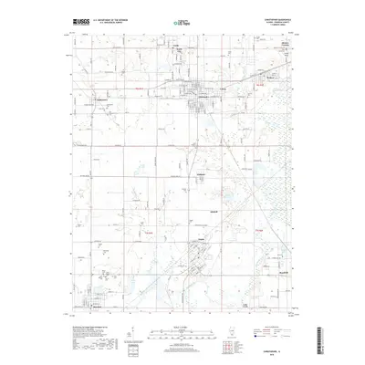
2018 Map of Christopher
USGS Topo · Published 2018About this map
Christopher and its neighboring coal towns define this portion of the Illinois landscape during the late 2010s. The settlement pattern is characterized by dense residential grids like Zeigler, Royalton, and Buckner, which are often flanked by industrial or municipal water sources such as the Buckner Reservoir and Zeigler Reservoir. The Big Muddy River winds through the southern portion of the quadrangle, where the terrain transitions into more fluid drainage patterns including Prairie Cr.
Find a feature on this map
179 named features on this map. Tap any name to fly to it.
Don’t see what you’re looking for? This feature index may not catch every label — zoom into the map to look around manually.
Map Details
Editions of this 2018 Christopher Map
This is the sole edition of this map. No revisions or reprints were ever made.
Other maps of this area

1909 · West Frankfort
USGS Topo · 1:62,500

1910 · Herrin
USGS Topo · 1:62,500

1926 · Duquoin
USGS Topo · 1:62,500

1936 · Herrin
USGS Topo · 1:62,500

1939 · Ina
USGS Topo · 1:62,500

1941 · West Frankfort
USGS Topo · 1:62,500

1943 · Ina
USGS Topo · 1:62,500

1949 · Paducah
USGS Topo · 1:250,000

1950 · Paducah
USGS Topo · 1:250,000

1954 · Paducah
USGS Topo · 1:250,000