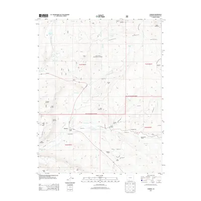
2013 Map of Chromo
USGS Topo · Published 2013About this map
Chromo and the high mesa country of Archuleta County are defined by a complex network of water engineering designed to sustain agriculture in this high-elevation landscape. The Navajo River and Little Navajo River serve as the primary arteries, feeding a series of irrigation channels such as the Midland Ditch, Enterprise Ditch, and Southside Ditch. This reliance on managed water is further evidenced by the Blanco Tunnel and Oso Tunnel, which cut through the terrain to redirect flow. The settlement pattern clusters near these water sources, with Spring Valley and Vigil Mesa marking the southern habitable zones before the terrain rises into the San Juan National Forest. The map also captures the transition from working ranch land to the high peaks of the Chalk Mountains and Chromo Mountain, illustrating how the early 21st-century landscape remains deeply tied to its hydrological infrastructure.
Find a feature on this map
63 named features on this map. Tap any name to fly to it.
Don’t see what you’re looking for? This feature index may not catch every label — zoom into the map to look around manually.
Map Details
Editions of this 2013 Chromo Map
This is the sole edition of this map. No revisions or reprints were ever made.
Other maps of this area

1913 · Summitville
USGS Topo · 1:125,000

1915 · Summitville
USGS Topo · 1:125,000

1945 · Durango
USGS Topo · 1:250,000

1953 · Durango
USGS Topo · 1:250,000

1954 · Durango
USGS Topo · 1:250,000

1954 · Aztec
USGS Topo · 1:250,000

1955 · Chama
USGS Topo · 1:62,500

1955 · Lumberton
USGS Topo · 1:62,500

1957 · Chromo
USGS Topo · 1:62,500

1957 · Chama Peak
USGS Topo · 1:62,500