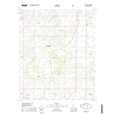
2018 Map of Chrysotile
USGS Topo · Published 2018About this map
Chrysotile sits at the heart of this rugged landscape within the Tonto National Forest in Gila County. The topography is defined by significant elevation changes, ranging from the depths of Hess Canyon and Tanks Canyon to the summits of Carol Spring Mtn and Timber Camp Mtn. This area is historically tied to asbestos mining, evidenced by the presence of Chrysotile Mine Rd winding through the terrain. Water management is a central theme of the modern landscape, with an extensive network of tanks such as Highway Tank, Carol Tank, and a series of numbered detention structures like Detention Number Five designed to capture runoff. To the south, Hess Flat provides a relatively level break near Jackson Butte before the land drops away into Sedal Canyon.
Find a feature on this map
63 named features on this map. Tap any name to fly to it.
Don’t see what you’re looking for? This feature index may not catch every label — zoom into the map to look around manually.
Map Details
Editions of this 2018 Chrysotile Map
This is the sole edition of this map. No revisions or reprints were ever made.
Other maps of this area

1922 · Chrysotile
USGS Topo · 1:125,000

1946 · Blue House Mtn
USGS Topo · 1:62,500

1951 · Blue House Mtn
USGS Topo · 1:62,500

1954 · Mesa
USGS Topo · 1:250,000

1957 · Mesa
USGS Topo · 1:250,000

1958 · Mesa
USGS Topo · 1:250,000

1960 · Mesa
USGS Topo · 1:250,000

1964 · Mesa
USGS Topo · 1:250,000

1966 · Brushy Canyon
USGS Topo · 1:24,000

1966 · Cassadore Spring
USGS Topo · 1:24,000