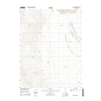
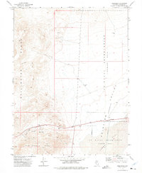
2015 Map of Chukar Canyon
USGS Topo · Published 2015About this map
Scheelite Mine Rd cuts through this high desert corridor in Churchill County, linking the steep drainages of the Sand Springs Range to the wide basin of Fairview Valley. This 2015 survey reveals a landscape defined by its network of deep canyons, including Chukar Canyon, Arterial Canyon, and Lucky Boy Canyon, which drain the mountainous western portion of the quadrangle. The presence of Lucky Boy Spring suggests a critical water source in an otherwise arid environment, while the northern reaches of the Fairview Range emerge in the southeast corner. The terrain transitions from the alluvial deposits of Labou Flat to rugged geological formations such as Breccia Canyon, reflecting the complex topography of the Great Basin during the early twenty-first century.
Find a feature on this map
16 named features on this map. Tap any name to fly to it.
Don’t see what you’re looking for? This feature index may not catch every label — zoom into the map to look around manually.
Map Details
Editions of this 2015 Chukar Canyon Map
This is the sole edition of this map. No revisions or reprints were ever made.
Other maps of this area

1908 · Carson Sink
USGS Topo · 1:250,000

1910 · Carson Sink
USGS Topo · 1:250,000

1957 · Reno
USGS Topo · 1:250,000

1959 · Reno
USGS Topo · 1:250,000

1960 · Reno
USGS Topo · 1:250,000

1972 · Fourmile Flat
USGS Topo · 1:24,000
1972 · Slate Mtn
USGS Topo · 1:24,000
1972 · Bell Canyon
USGS Topo · 1:24,000
1972 · Drumm Summit
USGS Topo · 1:24,000
1972 · Frenchman
USGS Topo · 1:24,000