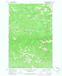
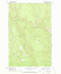
1968 Map of Chumstick Mtn
USGS Topo · Published 1981About this map
The Wenatchee Mountains and Entiat Mountains converge in this high-elevation landscape, dominated by a complex network of ridges and drainage basins. At the center of the survey lies Chumstick Mtn, surrounded by prominent features such as Sourdough Ridge, Kloochman Ridge, and Mosquito Ridge. The area is defined by its watershed patterns, where Tillicum Creek, French Creek, and Mad River carve through the terrain. Evidence of early land management and access is visible through the French Corral Road and various jeep trails, including the Swakane Jeep Trail that winds near the southern boundary. This map reveals the administrative layout of the Wenatchee National Forest, documenting the rugged transition between these two major Cascades mountain subranges before modern development altered forest access.
Find a feature on this map
32 named features on this map. Tap any name to fly to it.
Don’t see what you’re looking for? This feature index may not catch every label — zoom into the map to look around manually.
Map Details
Editions of this 1968 Chumstick Mtn Map
Other maps of this area

1901 · Chelan
USGS Topo · 1:125,000

1901 · Chiwaukum
USGS Topo · 1:125,000

1904 · Chiwaukum
USGS Topo · 1:125,000

1957 · Wenatchee
USGS Topo · 1:250,000

1964 · Leavenworth
USGS Topo · 1:62,500
1968 · Cashmere
USGS Topo · 1:24,000

1968 · Tyee Mtn.
USGS Topo · 1:24,000

1968 · Ardenvoir
USGS Topo · 1:24,000
1968 · Sugarloaf Peak
USGS Topo · 1:24,000

1968 · Baldy Mtn
USGS Topo · 1:24,000