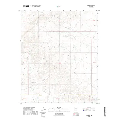
2020 Map of Chupadera
USGS Topo · Published 2020About this map
The settlement of Chupadera anchors this high-desert landscape in central New Mexico, situated near the boundary where Torrance and Socorro counties meet. The area is defined by a series of prominent canyons, including Cañon Saladito, Cañon Latigo, and Cañon Cueva, which carve through the high terrain. Water sources are critical landmarks in this arid environment, represented by reliable points like San Antonio Spring and various drainage basins such as Arroyo Seco and the Chupadera Arroyo.
Find a feature on this map
29 named features on this map. Tap any name to fly to it.
Don’t see what you’re looking for? This feature index may not catch every label — zoom into the map to look around manually.
Map Details
Editions of this 2020 Chupadera Map
This is the sole edition of this map. No revisions or reprints were ever made.
Other maps of this area

1954 · Socorro
USGS Topo · 1:250,000

1958 · Socorro
USGS Topo · 1:250,000

1962 · Socorro
USGS Topo · 1:250,000

1972 · Turkey Ridge
USGS Topo · 1:24,000
1972 · Chupadera Spring
USGS Topo · 1:24,000

1972 · Chupadera
USGS Topo · 1:24,000

1972 · Bigbee Draw
USGS Topo · 1:24,000

1972 · Abo
USGS Topo · 1:24,000
1972 · Scholle
USGS Topo · 1:24,000
1972 · Mesa Draw
USGS Topo · 1:24,000