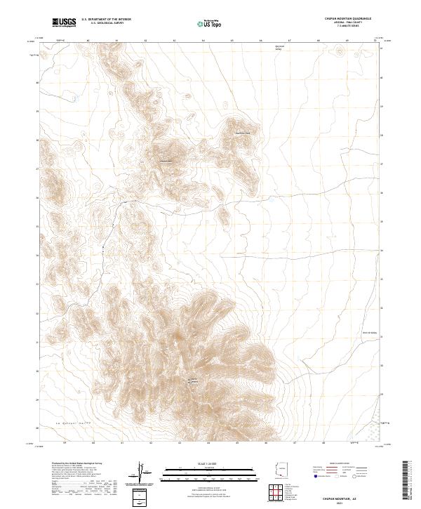
2021 Map of Chupan Mountain
USGS Topo · Published 2021About this map
Chupan Mtn and the southern Mesquite Mountains define this Pima County landscape, where topographic contours reveal a high-relief basin-and-range environment. The map details a transition from the elevated peaks of Mamtotk Peak down into the expansive alluvial floor of the La Quituni Valley and Kom Vo Valley. This recent survey by the U.S. Geological Survey captures the modern topography of these landforms, illustrating how the drainage patterns and desert terrain have been shaped over millennia. While the area remains largely undeveloped, the Public Land Survey System grids, including t17s r2w and t18s r1w, provide a framework for locating specific points of interest in this corner of the Sonoran Desert. The intersection of three distinct valleys—the La Quituni, Kom Vo, and Quijotoa Valley—highlights the complex hydrology and geography found within this region.
Find a feature on this map
12 named features on this map. Tap any name to fly to it.
Don’t see what you’re looking for? This feature index may not catch every label — zoom into the map to look around manually.
Map Details
Editions of this 2021 Chupan Mountain Map
This is the sole edition of this map. No revisions or reprints were ever made.
Other maps of this area

1953 · Ajo
USGS Topo · 1:250,000

1954 · Sonoyta
USGS Topo · 1:250,000

1957 · Ajo
USGS Topo · 1:250,000

1958 · Ajo
USGS Topo · 1:250,000

1962 · Ajo
USGS Topo · 1:250,000

1963 · Ajo
USGS Topo · 1:250,000

1963 · Kom Vo
USGS Topo · 1:62,500

1963 · Mt. Ajo
USGS Topo · 1:62,500

1963 · Pisinimo
USGS Topo · 1:62,500

1963 · Lukeville
USGS Topo · 1:250,000