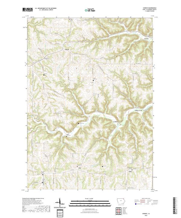
2022 Map of Church
USGS Topo · Published 2022About this map
Church and the surrounding townships of Allamakee County are characterized by the steep, winding drainages of the Driftless Area. The landscape is defined by the high prominence of Lansing Ridge and the deep incisions of Village Creek and Trout Run. Small hamlets and crossroads like Elon and Dalby serve as focal points for the rural community, while the presence of numerous denominational cemeteries, such as the West Paint Creek Synod Cem and Center Baptist Cem, reflects the early ethnic and religious settlement patterns of the region.
Find a feature on this map
72 named features on this map. Tap any name to fly to it.
Don’t see what you’re looking for? This feature index may not catch every label — zoom into the map to look around manually.
Map Details
Editions of this 2022 Church Map
This is the sole edition of this map. No revisions or reprints were ever made.
Other maps of this area

1903 · Waukon
USGS Topo · 1:125,000

1929 · Ferryville
USGS Topo · 1:62,500

1929 · Prairie Du Chien
USGS Topo · 1:62,500

1932 · Ferryville
USGS Topo · 1:62,500

1932 · Prairie Du Chien
USGS Topo · 1:62,500

1958 · La Crosse
USGS Topo · 1:250,000

1961 · La Crosse
USGS Topo · 1:250,000

1965 · La Crosse
USGS Topo · 1:250,000

1966 · Ferryville
USGS Topo · 1:62,500
1967 · Prairie Du Chien
USGS Topo · 1:62,500