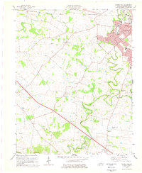
1978 Map of Church Hill
USGS Topo · Published 1979About this map
Hopkinsville anchors the northeastern corner of this 1970s landscape, showing the city's residential expansion through neighborhoods like Millbrooke and developments along North Drive. Outside the city limits, the terrain of Christian County is defined by the winding paths of the North Fork Little River and South Fork Little River, which converge amidst a network of rural settlements. Small communities and historical gathering points such as Church Hill and Merrittstown are identifiable by their clusters of homes and local institutions like South Union Ch and Hebron Ch.
Find a feature on this map
44 named features on this map. Tap any name to fly to it.
Don’t see what you’re looking for? This feature index may not catch every label — zoom into the map to look around manually.
Map Details
Editions of this 1978 Church Hill Map
2 editions found
Other maps of this area

1944 · Clarksville
USGS Topo · 1:50,000

1950 · Caledonia
USGS Topo · 1:24,000

1951 · Church Hill
USGS Topo · 1:24,000

1951 · Caledonia
USGS Topo · 1:24,000

1951 · Hopkinsville
USGS Topo · 1:24,000

1951 · Roaring Spring
USGS Topo · 1:24,000

1951 · Herndon
USGS Topo · 1:24,000

1951 · Oak Grove
USGS Topo · 1:24,000

1952 · Pleasant Green Hill
USGS Topo · 1:24,000

1952 · Kelly
USGS Topo · 1:24,000