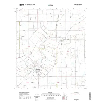
2020 Map of Church Point
USGS Topo · Published 2020About this map
Church Point serves as the focal point of this Cajun Prairie landscape, where the town's dense grid meets the sprawling agricultural tracts of Acadia Parish and St Landry Parish. The area is defined by its deep cultural roots and aviation history, evidenced by a concentration of small landing strips including Briggs Airfield, Kibs Air Park, and the cryptically named Lost Airfield. To the north, the elevated ground of Plaquemine Ridge rises above the drainage of Bayou Wikoff, influencing the local road network and settlement patterns. Genealogy and local history are preserved at several sites, most notably at the Our Lady of Sacred Heart Cem and Mcbride Cem, which mark the community's early established centers near the village of Lewisburg.
Find a feature on this map
149 named features on this map. Tap any name to fly to it.
Don’t see what you’re looking for? This feature index may not catch every label — zoom into the map to look around manually.
Map Details
Editions of this 2020 Church Point Map
This is the sole edition of this map. No revisions or reprints were ever made.
Other maps of this area

1935 · Branch
USGS Topo · 1:31,680

1939 · Opelousas
USGS Topo · 1:62,500

1947 · Branch
USGS Topo · 1:31,680

1947 · Chataignier
USGS Topo · 1:31,680

1947 · Pitreville
USGS Topo · 1:31,680

1952 · Lake Charles
USGS Topo · 1:250,000

1954 · Lake Charles
USGS Topo · 1:250,000

1956 · Opelousas
USGS Topo · 1:62,500

1957 · Opelousas
USGS Topo · 1:62,500

1957 · Carencro
USGS Topo · 1:62,500