Old Maps of St. Landry Parish, Louisiana
Explore 202 old maps of St. Landry Parish, spanning from 1935 to today. These high-resolution historic maps reveal how streets, neighborhoods, landmarks, and natural features evolved over time — perfect for genealogy, metal detecting, research, and local history exploration.
What you can do with these maps:
- See how St. Landry Parish changed over time: Compare historical maps to modern-day views to trace roads, homesites, rail lines & more.
- View detailed metadata: Each map includes creators, publishers, year, scale, and archive source.
- Overlay maps with satellite & LiDAR: Visualize the past alongside modern tools to explore terrain & human change.
- Trusted historical sources: Maps sourced from the USGS, Library of Congress, and other archives.
- Access maps your way: View online, download high-res files, or order prints for personal or research use.
Start exploring old maps of St. Landry Parish to uncover forgotten places, hidden landmarks, and the deep history beneath your feet.
St. Landry Parish, LA maps
(202)- 1935 Map of Osca Bayou, 1938 Print
 1935 Osca Bayou1938 Print · USGSThe Atchafalaya Basin in the mid-1930s is a complex web of wetlands and early river engineering projects. Researchers can trace historic family locations and transit routes near Maringouin, Butte La Rose, and the St Joseph Ch & Cem.
 - 1939 Map of Opelousas, 1942 Print
 1939 Opelousas1942 Print · USGSSt. Landry Parish is revealed at a moment of industrial and agricultural transition in the late thirties. Researchers can trace family roots through numerous parish schools and churches, including Gradney Island Sch, Mohin Ch & Cem, and the Wartell Plantation.2 unique versions available
 - 1939 Map of Fordoche, 1948 Print
 1939 Fordoche1948 Print · USGSThe rail-and-river corridor of Pointe Coupee Parish comes alive in this late 1930s survey, showing the land just as new flood controls were being established. Researchers can trace family history through rural community anchors like Sunlight Ch & Cem, Lottie, and Elliot City.2 unique versions available
 - 1940 Map of Arnaudville, 1964 Print
 1940 Arnaudville1964 Print · USGSThe Cajun heartland of the 1940s is detailed here as it manages its complex relationship with the Atchafalaya. Genealogists can trace family names through landmarks like Le Bourgeois Plantation, Magenta Plantation, and the St Elizabeth Ch & Sch.
 - 1947 Map of Redland
 1947 Redland1947 Print · USGSThe prairies of southern Louisiana come alive in this post-war map of the area around Eunice and the Bayou des Cannes. Researchers can trace old rail corridors like the Southern Pacific and locate rural landmarks such as Duralde Sch and Fenris.
 - 1947 Map of Chataignier
 1947 Chataignier1947 Print · USGSCoastal prairie life and Bayou country are captured here in the late Forties at the edge of the Evangeline and St. Landry Parish line. Genealogists can trace early homesteads and landmarks like St. Joseph Ch and Point Blue Sch along the Texas and Pacific rail line.
 - 1947 Map of Eunice
 1947 Eunice1947 Print · USGSThe rail-and-bayou landscape of south Louisiana comes alive in the mid-1940s, centered on the growing town of Eunice. Local researchers can trace family roots through rural landmarks like Bozyone Sch and the smaller settlements of Mowata and Amy.
 - 1947 Map of Pitreville
 1947 Pitreville1947 Print · USGSLouisiana's Acadia and St. Landry parishes are captured here in the mid-1940s, showing a rural landscape shaped by winding bayous and early highways. Genealogists and local historians can locate family landmarks like Courville Cem, Hundley Sch, and the Acadia Academy.
 - 1948 Map of Bunkie, 1950 Print
 1948 Bunkie1950 Print · USGSThe Bunkie area during the late 1940s reveals a landscape defined by Bayou Boeuf and a dense network of early oil infrastructure. Genealogists can trace family roots through numerous rural landmarks like St Lukes Ch & Cem and the Goudeau Sch.
 - 1952 Map of Lake Charles
 1952 Lake Charles1952 Print · USGSSouthwest Louisiana is captured here in the mid-fifties, showing a landscape defined by the rise of the petrochemical industry and deep-water navigation. Researchers can trace family roots through numerous small-town settlements and oil developments like Nibletts Bluff, the Lockport Oil Field, and Starks.
 - 1954 Map of Lake Charles, 1964 Print
 1954 Lake Charles1964 Print · USGSSouthwest Louisiana in the mid-fifties is defined by its massive petroleum industry and its complex network of bayous and rail lines. Researchers can trace the development of the Sulphur Mines Oil Field or locate historic settlements like Longville and De Quincy.3 unique versions available
 - 1954 Map of Baton Rouge, 1974 Print
 1954 Baton Rouge1974 Print · USGSSoutheast Louisiana in the mid-fifties is captured here during a period of transition for its river and rail economies. Researchers can trace the path of the Mississippi River and find landmarks like the Bonnet Carre Spillway and Bayou Plaquemine.2 unique versions available
 - 1955 Map of Osca Bayou
 1955 Osca Bayou1955 Print · USGSThe Atchafalaya Basin in the mid-fifties is captured here as a landscape of deep bayous and growing oil production. Genealogists and historians can trace rail-side life in Maringouin or find remote river landmarks like Butte La Rose and the Happytown Oil Field.
 - 1955 Map of Fordoche
 1955 Fordoche1955 Print · USGSMid-century Pointe Coupee Parish reveals a landscape of massive flood control projects and active bayou life during the 1950s. Genealogists and researchers can locate family landmarks like Argyle Plantation or the Zion Traveler Ch & Cem and trace the early development of the Fordoche Oil Field.
 - 1955 Map of Odenburg
 1955 Odenburg1955 Print · USGSLouisiana's river country comes alive in the mid-1950s as it transitions from a landing-based economy to modern rail and flood control. Researchers can trace family sites at Jacoby Chapel & Cem or locate historic river landings like Hicks Ldg and Speer Ldg.
 - 1956 Map of Opelousas
 1956 Opelousas1956 Print · USGSSt. Landry Parish in the mid-fifties shows a landscape of productive prairies and complex bayou engineering. Genealogists and historians can trace family locations through numerous rural landmarks like Sacred Heart Ch & Cem, Wartell Plantation, and Thistlewaite.
 - 1956 Map of Baton Rouge
 1956 Baton Rouge1956 Print · USGSSouth Louisiana at the height of the mid-century oil boom shows a landscape of river oxbows and rising industry. Researchers can trace family roots through river towns like Scotlandville or locate early industrial sites and Oil wells near Lake Maurepas.
 - 1957 Map of Opelousas, 1958 Print
 1957 Opelousas1958 Print · USGSSt. Landry Parish in the late fifties showcases a landscape of bayous and railroads at the height of the local oil and gas boom. Genealogists and historians can trace family-named sites like Bertrand Cem, Chimleyville Ch, and the Academy of Immaculate Conception.2 unique versions available
 - 1957 Map of Carencro, 1958 Print
 1957 Carencro1958 Print · USGSMid-century south Louisiana comes alive in this survey of the prairies and bayous of Acadia and St. Landry Parishes. Genealogists and historians can trace family locations near Church Point, Grand Coteau, and Vatican, or find rural landmarks like Sacred Heart Academy and Mt Calvary Cem.2 unique versions available
 - 1959 Map of Osca Bayou, 1960 Print
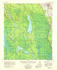 1959 Osca Bayou1960 Print · USGSThe Atchafalaya Basin in the late fifties was a landscape of remote bayous and emerging oil fields. Genealogists can trace family names at St Peter Cem or explore the rail-linked settlements of Maringouin and Musson.4 unique versions available
 - 1959 Map of Eunice, 1960 Print
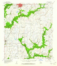 1959 Eunice1960 Print · USGSThe Acadia Parish prairie comes to life in the late fifties as a hub of petroleum and rail activity. Genealogists and local historians can locate many rural landmarks including Acadia Academy, Maxie Church, and family cemeteries like Savoy and Hebert.3 unique versions available
 - 1959 Map of Fordoche, 1962 Print
 1959 Fordoche1962 Print · USGSLouisiana's river country is captured here in the late fifties, as the oil industry began to shape the landscape of Pointe Coupee Parish. Genealogists can locate family landmarks like Cottonwood Cem., Argyle Plantation, and the Sunlight Ch. near Blanks.2 unique versions available
 - 1959 Map of Palmetto, 1962 Print
 1959 Palmetto1962 Print · USGSSt. Landry Parish is mapped here just before the 1960s, showing the intersection of heavy industry, rail transport, and deep-water management. Researchers can locate family landmarks such as Godeau Cem., rural schools like Krotz Springs Sch., and the early footprints of the Melville Gas Field.2 unique versions available
 - 1960 Map of Ville Platte, 1961 Print
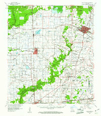 1960 Ville Platte1961 Print · USGSEvangeline Parish at the start of the sixties shows a landscape of prairie rice farms, oil fields, and traditional Acadian settlements. Researchers can locate many family cemeteries and community landmarks like St Ann's Cem, Savoy Hosp, and the Mamou Oil Field.3 unique versions available
 - 1961 Map of Baton Rouge, 1966 Print
 1961 Baton Rouge1966 Print · USGSSoutheastern Louisiana in the early sixties remains a landscape of deep river bends and sprawling coastal lakes. Genealogists and historians can trace the rail-and-river economy through landmarks like Free-Nigger Point, Donaldsonville, and the Illinois Central Railroad.
Showing maps 1-25 of 202
Top cities of St. Landry Parish
- Opelousas historical maps
- Eunice historical maps
- Sunset historical maps
- Port Barre historical maps
- Melville historical maps
- Krotz Springs historical maps
See more
Frequently asked questions
- What are the different types of historical maps available for St. Landry Parish?
- What is the oldest map of St. Landry Parish?
- Where can I purchase historical maps of St. Landry Parish for my home or office?
- Where can I download high-res historical maps of St. Landry Parish?
- Are there historical topographic maps available for St. Landry Parish?
- Is there historical aerial imagery available for St. Landry Parish?
- Where are historical maps of St. Landry Parish sourced from?