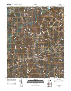
2010 Map of Church Road
USGS Topo · Published 2010About this map
Namozine and Marmora anchor this rural landscape in Amelia County, where the southern boundary is defined by the winding course of Bar Swamp Creek and Hatcher Run. The area's settlement pattern is closely tied to its waterways and early transport corridors, with the village of Church Road positioned near the intersection of several significant local arteries. The terrain is notably dissected by numerous branches, including Pucketts Branch, Georges Branch, and Tylers Branch, which feed into the larger Namozine Creek.
Find a feature on this map
44 named features on this map. Tap any name to fly to it.
Don’t see what you’re looking for? This feature index may not catch every label — zoom into the map to look around manually.
Map Details
Editions of this 2010 Church Road Map
This is the sole edition of this map. No revisions or reprints were ever made.
Other maps of this area

1897 · Amelia
USGS Topo · 1:125,000

1943 · Goodes Bridge
USGS Topo · 1:31,680

1943 · De Witt
USGS Topo · 1:24,000

1943 · Dinwiddie
USGS Topo · 1:24,000

1943 · Beach
USGS Topo · 1:24,000

1943 · Church Road
USGS Topo · 1:24,000

1943 · Winterpock
USGS Topo · 1:24,000

1943 · Sutherland
USGS Topo · 1:24,000

1943 · Richmond
USGS Topo · 1:250,000
1944 · Winterpock
USGS Topo · 1:31,680